
 Sign In
 Create Account


Scheduling and Routing is the bread and butter of a transit system. Without it, you wouldn't have a transit system. Some key points to remember are: stay on main roads wherever possible, service many destinations, avoid tedious detours, and run a decent schedule.
The map I will be using is one of Appleton, WI, the city that is featured first in this game. The map is different from Tutorial I, and that is so you can see how I map out my routes this round.
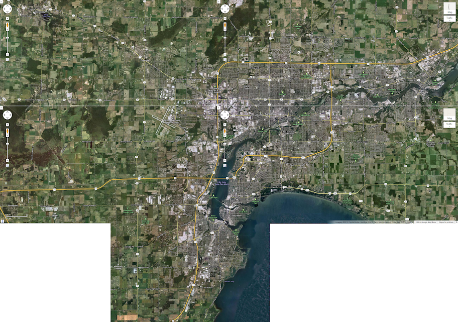
As you can see, the map covers a lot of ground. This is the map I will be using to present my bus system.
Lets start with routing. The basic concept is to have routes that are within walking distance of people, yet still on main roads. In the Midwest, most main streets are about .5 to 1 mile apart, making it easy to have routes within walking distance. Two way routes are strongly preferred, in order to allow people to take a direct bus to their destination without going the "wrong way".
A useful tool to use in route planning is the directions feature in Google Maps. Trace out your route using the directions. In order to make schedules easier for the next steps, plan routes that are in multiples of 20. Meaning, have the "drive time" be 20, 40, 60, 80, 100... minutes.
The first route I planned out was the North-South one furthest to the east. From Downtown, the route heads east to a main road, Lawe Street. The bus heads north on Lawe, then turns right onto Pacific in order to better serve the neighborhood to the east. The bus then heads north on Owaissa Street.
Why does the bus head on Owaissa Street instead of following the main roads? After all, it does take slightly longer.
The answer is because of the railroad tracks. If you zoom in closely, the tracks form a community barrier like a freeway or a river would. There are crossings only every couple of blocks, forcing the residents to detour to cross the tracks.
Heading east on Glendale, the route heads north on County Road "E" across the Highway. Because of the complexities of serving the area north of the Highway, the bus uses a one way turnaround loop to get within a reasonable distance of houses. One way loops are tolerable at the end of routes, because people aren't riding any further than the loop. The bus then heads back down the route, only in reverse.

Remember when I told you to keep the routes at 20, 40, 60... drive times? That is because of scheduling. A secret I found out is that the actual time for a bus route is the drive time multiplied by 1.5. Those times divide evenly into clockface routes, where the bus arrives at the same time all day. Clockface routes also allow dividing a 60 minute route into 30, 20, 15, 12, 10 headways. The route likely won't need more than 30 minute service with 30' or shorter buses, because it doesn't serve many activity centers.
There you have it; the basics of scheduling and routing. Happy scheduling!


 Back to top


